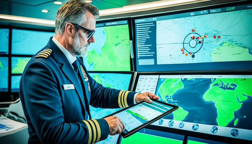
Are you still using old-school paper charts for ship route planning? It's time to switch to Electronic Chart Display and Information System (ECDIS) technology. ECDIS is now a must-have for most ships, thanks to SOLAS regulations.

It's key to know how this advanced system can change your voyage planning for the better.
ECDIS has evolved a lot since it first came out. It now keeps your charts up to date and helps with better passage planning. By combining tools like radar and GPS, ECDIS gives you a clearer view of your surroundings. It also updates you on hazards in real-time, making your journey safer and smoother.
This guide will take you through the world of ECDIS route planning. We'll look at its main parts, the perks, and how to use it right. You'll learn how to gather important data and find the best routes for saving fuel and cutting costs. Get ready to unlock the full potential of this powerful tool.
Key Takeaways
ECDIS is mandatory for most ships under SOLAS regulations, replacing traditional paper charts
ECDIS integrates navigational aids and provides real-time updates for enhanced safety and efficiency
Effective ECDIS route planning involves considering key elements such as route, route check, parallel indexing, and no-go areas
ECDIS route planning should align with company requirements and industry guidelines
Optimizing routes using ECDIS can lead to significant fuel savings and reduced operational costs
Understanding ECDIS: The Basics
The Electronic Chart Display and Information System (ECDIS) has changed the way ships navigate. It gives sailors a powerful tool for safe and efficient trips. ECDIS uses real-time ship data and electronic charts to improve awareness and decision-making on the bridge.
What is ECDIS and How Does it Work?
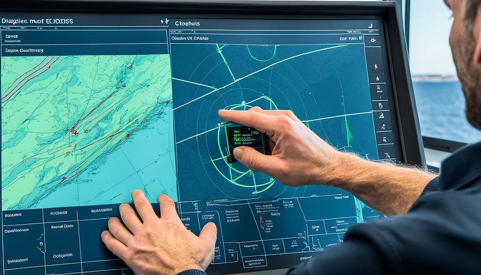
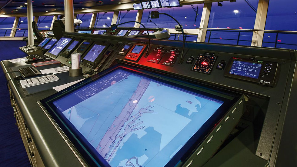
ECDIS is a computer system for navigation that meets International Maritime Organization (IMO) standards. It shows electronic charts and combines data from GPS, radar, and AIS. This gives a full view of the ship's location, course, and the area around it. With ECDIS, officers can plan routes, track progress, and make smart decisions for safety and efficiency.
The Evolution of ECDIS Technology
ECDIS technology has seen big improvements since it's advent. Updates now focus on making the software, hardware, documentation, and practices better. These changes have made ECDIS a key tool for modern navigation, with many ships using it as their main navigation system.
Key Components of an ECDIS System
An ECDIS system has important parts that work together for accurate navigation:
Electronic Navigational Charts (ENCs): These are the digital maps that show water depths, hazards, and navigation aids.
Position Sensors: GPS, gyrocompass, and speed log update the ship's location and movement on the ECDIS.
Voyage Planning Tools: Officers use these to plan, change, and check routes, considering weather, tides, and ship details.
Alarm Systems: These alert the crew to dangers, like going off course or getting too close to shallow water.

The Importance of Efficient Route Planning in Maritime Operations
In the maritime world, planning efficient routes is key for safe, cost-effective, and rule-following operations. Thanks to ECDIS, planning routes are now more precise and efficient. This helps ship operators make safer choices, cut down on risks, use less fuel, and follow global rules.
Enhancing Safety and Reducing Risks
Planning routes well makes ships safer and lowers risks. ECDIS helps with this by planning routes in detail, figuring out distances and hazards. It uses the latest Electronic Navigational Charts (ENCs) and real-time weather info to spot and dodge dangers. This keeps the crew and ship safe.
Optimizing Fuel Consumption and Costs
Effective route planning is crucial for fuel conservation and cost reduction. By considering weather conditions, currents, and ship performance, operators can identify optimal routes. This approach not only saves money but also benefits the environment by reducing fuel consumption.
Route Planning Method | Weather Updates per Day |
Early days of shipping | 1 bulletin per 24 hours |
Weather fax | 2 to 4 updates, depending on ship's location |
Onboard routing software | Real-time weather information and forecasts |
Ensuring Compliance with International Regulations
Adhering to international regulations is essential in maritime navigation. The SOLAS Convention and IMO Resolution A.893-21 outline the procedures for route planning. Employing ECDIS for route planning and traffic management assists operators in complying with these regulations, preventing legal issues and maintaining high standards of safety and professionalism.
Preparing for Voyage Planning with ECDIS
Preparing for a safe and efficient nautical passage using ECDIS is essential. Start by collecting all necessary data from various sources, similar to the process with traditional paper charts. This information is crucial for selecting the optimal route that complies with company policies and industry regulations.
Gathering Essential Data and Information
For voyage planning, navigators need to collect and look over a lot of information. This includes:
Chart catalogues and Notices to Mariners
Sailing directions and pilot books
Port Distance calculating software or tables
Ocean Passages of the World
Tide Tables and Tidal stream information
Considering Environmental Factors and Weather Conditions
When organizing a voyage, considering the environment and weather is crucial. These elements can significantly impact the safety and efficiency of the journey. Therefore, utilizing the most recent weather forecasts and ocean data in the planning process is essential.
Key environmental factors to consider include:
Factor | Description | Impact on Voyage Planning |
Wind | Speed and direction of wind | Affects vessel stability and fuel consumption |
Waves | Height, period, and direction of waves | Influences vessel motion and speed |
Currents | Speed and direction of ocean currents | Impacts vessel speed and course over ground |
Visibility | Presence of fog, rain, or other conditions affecting visibility | Determines safe speed and lookout requirements |
Considering these environmental factors and incorporating them into planning allows navigators to create safer and more efficient routes, thereby reducing risks and enhancing performance.
Proper preparation is the foundation of successful nautical passage planning. By gathering essential data, consulting with maritime experts, and considering environmental factors, navigators can create robust and efficient voyage plans that enhance safety and compliance.
Creating a Route in ECDIS
Selecting Waypoints and Defining the Track
The first step in making a route in ECDIS is picking waypoints and setting the track. Navigators use the graphical editor to mark waypoints along the desired path. They make sure it meets company rules and industry standards. This process is easy and quick, allowing for quick changes and tweaks using the table editor for better accuracy.
When picking waypoints, navigators should consider:
Safe distances from hazards
Traffic separation schemes and recommended routes
Weather and environmental factors
Fuel efficiency and optimal speed
Setting Safety Parameters and Alarms
After defining the route, navigators set safety parameters and alarms. These follow company policies and the master's requirements. ECDIS lets you easily set these limits. It gives visual and sound alerts if the vessel goes off course.
Important safety settings in ECDIS include:
Depth contours and safety depths
No-go areas and danger zones
Wheel-over positions and turning radius
Under keel clearance and squat calculations
Incorporating Tidal and Current Data
To make the route safer and more accurate, navigators add tidal and current data to ECDIS. This info is key for planning the best times for arriving or leaving port, and for keeping enough under keel clearance in shallow waters. By using real-time tidal and current data, ECDIS helps adjust the route to changing conditions. This keeps the passage safe and efficient.
Data Type | Importance in Route Planning |
Tidal heights and times | Ensures safe navigation in shallow waters and optimal port arrival/departure times |
Current direction and speed | Affects vessel speed and course, requiring adjustments to maintain efficiency |
Tidal streams and currents | Influences vessel movement and requires consideration when planning maneuvers |
By using ECDIS' advanced features and important data, navigators can make safe, efficient, and compliant routes. The mix of voyage planning software and electronic chart display has changed ship navigation. It ensures a higher level of safety and operational excellence in the maritime industry.

Conducting Route Checks and Safety Analysis
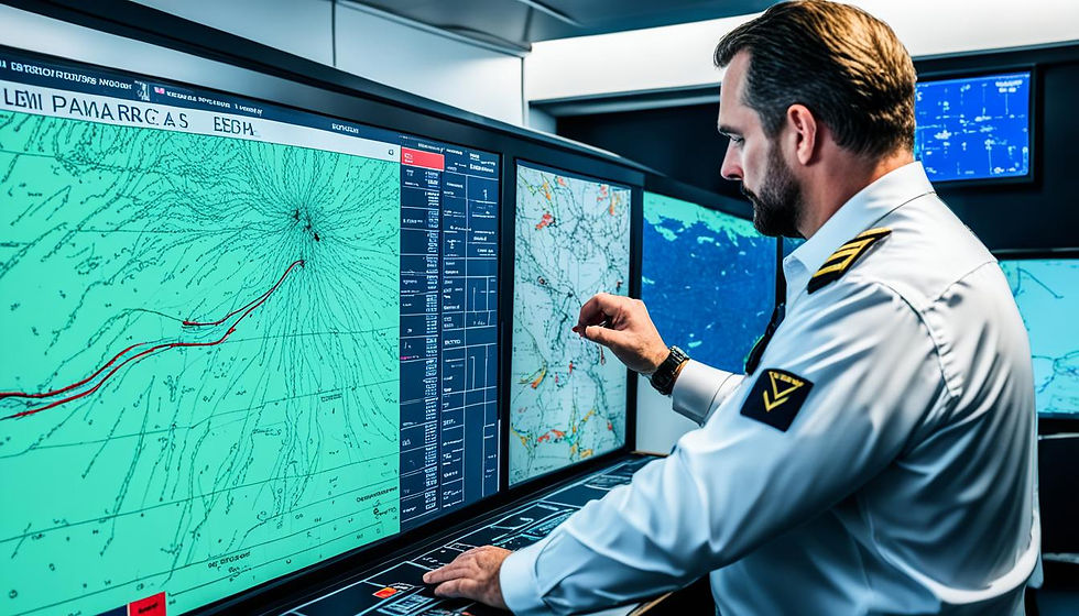
Once a route is created in ECDIS, it is crucial to thoroughly review it to ensure it is safe and complies with Company regulations. This involves identifying hazards, assessing risks, and making adjustments to circumvent them. ECDIS's sophisticated tools assist sailors in enhancing the safety and efficiency of their routes.
Verifying Route Compliance with Company Policies
Before sailing, it's important to check the route meets the ship's needs and company rules. This means checking the depth of the water, the ship's clearance, and other important details. ECDIS lets users set safety levels that fit the ship's specific needs, making sure the route is right for the vessel.
Identifying Potential Hazards and Risks
The "Route Check" or "Safety Check" feature in ECDIS is an excellent tool for identifying hazards along the planned route. It examines factors such as:
Water depth and safety contours
Prohibited areas and restricted zones
Navigational hazards (e.g., wrecks, obstructions)
Traffic separation schemes and shipping lanes
Sailors must give careful consideration to any warnings from the Route Check. These alerts indicate areas where the route could be hazardous or violate regulations, assisting sailors in making informed decisions and steering clear of dangers.
Safety Parameter | Description |
Safety Contour | The minimum depth contour that the vessel can safely navigate, based on draft and UKC |
Safety Depth | The minimum safe water depth, calculated by adding the vessel's draft, UKC, and other factors |
Cross Track Distance | The maximum allowable deviation from the planned route before triggering an alarm |
Turning Radius | The minimum turning radius of the vessel, used to ensure safe maneuverability along the route |
Applying Necessary Route Modifications
If the Route Check identifies issues, sailors may need to alter the route for safety. This might involve shifting waypoints, steering clear of hazards, or implementing additional safety precautions. ECDIS facilitates easy route modifications and updates, enabling sailors to make these adjustments swiftly.
By doing thorough route checks and safety analyses, sailors use ECDIS's advanced features to improve their awareness, spot risks, and make better routes. This careful planning is key for keeping maritime operations safe and efficient.
Optimizing Routes for Efficiency and Cost-Effectiveness
In the maritime industry, optimizing ship routes is essential for improving efficiency and reducing costs. By utilizing advanced voyage planning software and analyzing factors such as weather, currents, and ship speed, ship owners can identify the most effective routes, resulting in smoother and more economical operations.
Ship route planning has greatly advanced due to new technology. AI plays a major role in this, as there are now advanced software systems based on AI principles. These tools use intelligent learning to choose the best routes considering weather, speed, and performance, improving the accuracy and efficiency of ship operations.
Optimizing ship routes also helps the environment. By using less fuel and adjusting engine speed, it cuts down on harmful emissions.
Benefits of Ship Routing Optimization | Impact |
Reduced Fuel Consumption | 2% to 4% less fuel used and less GHG emissions |
Improved Safety | Finds safe routes and follows ECDIS rules |
Enhanced Efficiency | Makes things run smoother and helps control when you arrive |
Cost Savings | Reduces costs by planning better and optimizing routes |
Monitoring and Updating Routes During the Voyage
After a ship sets sail, ensuring it stays on the correct route is essential. Voyage monitoring systems assist in this process. They monitor the ship's position and modify plans as necessary to ensure safety and efficiency.
ECDIS is an important tool for monitoring. It displays the ship's location and alerts the crew to potential hazards, helping them maintain the course and avoid dangers.
Real-Time Tracking and Position Monitoring
Real-time tracking uses many tools and sensors with ECDIS. These include:
Global Positioning System (GPS) receivers
Automatic Identification System (AIS) transponders
Radar and other collision avoidance systems
Depth sounders and echo sounders
Speed and distance measuring equipment
ECDIS updates the ship's position and speed from this data. It shows this on electronic charts. This helps the crew see where they are and spot problems early.
Adapting to Changing Conditions and Circumstances
Ships face unexpected challenges at sea. These can be:
Changes in weather, like storms or high winds
Changes in ocean currents and tides
Changes in traffic or port schedules
Mechanical issues or equipment failures
Being able to change the route is key to safety and efficiency. ECDIS lets the crew quickly adjust the route. They can add or remove waypoints, change speed, or follow new rules. This keeps the ship safe while avoiding dangers.
Scenario | ECDIS Response |
Approaching storm | Alter course to avoid severe weather |
Unexpected marine traffic congestion | Adjust speed and route to maintain safe distance |
Port closure or schedule change | Modify route to accommodate new port of call |
Equipment malfunction or failure | Adapt route to facilitate repairs or emergency response |
Best Practices for ECDIS Route Planning
Maximizing the benefits of the ECDIS navigation system requires effective route planning. Adhering to these guidelines enables maritime professionals to properly utilize the electronic chart display, thereby reducing navigational risks.
Regularly Updating Electronic Navigational Charts (ENCs)
Keeping ENCs up-to-date is vital for ECDIS route planning. ENCs are the base for accurate navigation and making good decisions. Updating them often means the crew gets the latest info on water depths, hazards, and new rules. This lowers the chance of running into unexpected problems on the voyage.
Maintaining Accurate System Configuration
Getting the ECDIS system set up right is key for safe and accurate route planning. This means making sure GPS, gyrocompass, and speed log data is correct. Also, setting safety limits like cross-track distances and depth contours helps spot hazards. Regular checks on the ECDIS hardware and software keep it running smoothly.
Configuration Element | Importance |
Sensor Inputs | Accurate position, heading, and speed data for precise navigation |
Safety Parameters | Identification of potential hazards along the planned route |
Hardware and Software Maintenance | Ensuring optimal performance and reliability of the ECDIS system |

Ensuring Proper Crew Training and Familiarization
The crew's expertise and understanding of the ECDIS system are essential. They must know how to operate it, recognize its limitations, and identify critical information. Proper training in interpreting electronic charts and managing alarms is vital. Regular drills ensure they remain prepared for various scenarios.
More than 90% of maritime professionals view passage planning in ECDIS as essential for ensuring the safety and efficiency of ship voyages.
Integration of ECDIS with Other Bridge Systems
ECDIS can be easily linked with other key navigation tools on the bridge. This makes situational awareness and ship routing better. It works well with radar, Automatic Identification Systems (AIS), and weather routing software. This creates a full and efficient way to plan voyages.
Interfacing with Radar and AIS
Linking ECDIS with radar lets you see radar targets on the electronic chart. This helps in avoiding collisions. It helps navigators spot potential dangers and keep a safe distance from other ships.
Adding AIS data to ECDIS shows real-time info on nearby ships. This includes their location, speed, and direction. This makes navigating busy areas safer and more confident.
An electronic chart display and information system (ECDIS) allows the integration of other operational data, such as ship's course and speed, depth soundings, automatic identification systems (AIS) information, and radar data into the display.
Incorporating Weather Routing Software
Weather routing software can be integrated into ECDIS to enhance route planning. It examines current and future weather conditions, aiding in identifying the safest and most efficient route for a journey.
This means routes can change in real-time to avoid bad weather and save fuel. It makes planning a trip more dynamic.
Benefit | Description |
Reduced Voyage Planning Time | A connected ECDIS can reduce the time taken for voyage planning from 4-5 hours to about 30 minutes. |
Fuel Savings | Ship owners can save 5-10% in fuel expenses annually through better fleet performance management facilitated by a connected ECDIS. |
Improved Problem Resolution | The process-driven design enabled via connectivity helps in reducing process-related questions, which are the primary cause of most problems, leading to faster problem resolution. |
By linking ECDIS with other bridge systems, ship owners and operators can make voyages safer and more efficient. This approach helps follow international rules and find the best routes. It also saves money and is better for the environment.
Aspect | Consideration |
Vessel Characteristics | Size, draft, speed, maneuverability |
Cargo Requirements | Type, weight, special handling needs |
Environmental Factors | Weather, tides, currents, ice conditions |
Regulatory Constraints | SOLAS, MARPOL, local regulations |

To maximize the benefits of ECDIS and enhance route planning, ship owners should prioritize crew training and system maintenance. Updating electronic charts and software provides navigators with the most current information. By doing this and taking a proactive approach to planning, the shipping industry can boost safety, efficiency, and environmental stewardship globally.
Conclusion
ECDIS technology has revolutionized the way ships plan routes and voyages, making tasks easier for mariners and improving ship operations. Presently, 80% of mariners favor ECDIS for voyage planning over traditional paper charts, and 90% of ship owners report enhanced operational efficiency.
ECDIS has decreased workload, increased awareness, and ensured compliance with international regulations, becoming crucial for safe and efficient navigation. To fully benefit from ECDIS, maritime professionals must understand its functionality and best practices.
This includes keeping electronic charts updated, ensuring proper system settings, and training the crew. Ship masters play a key role in ensuring their crew is proficient in ECDIS. By staying informed about new technology and best practices, maritime operators can improve route planning, reduce fuel consumption, and lower accident risks.
The maritime industry is constantly evolving. It's important to adopt new technology while preserving traditional skills. Many training centers encounter challenges updating their ECDIS programs, but integrating both digital and traditional methods is crucial. By combining ECDIS with other systems like radar and AIS, and using weather routing software, ships can enhance navigation.
Monitoring ECDIS and adjusting it during voyages ensures safer, more efficient, and compliant operations, contributing to the success of the maritime industry.
FAQ
What is ECDIS and how does it enhance ship route planning?
ECDIS, or Electronic Chart Display and Information System, is a computer system that integrates real-time ship data with electronic charts. This facilitates safer and more efficient voyage planning by providing detailed information and automatic calculations.
What are the key components of an ECDIS system?
An ECDIS system includes electronic charts, position sensors like GPS, and voyage planning tools. These components work together to deliver accurate and up-to-date information for safe navigation and efficient route planning.
How does efficient route planning contribute to maritime safety and cost-effectiveness?
Efficient route planning with ECDIS enhances maritime safety by identifying hazards and reducing risks, ensuring compliance with international regulations. It also saves fuel and reduces costs by selecting optimal routes based on weather and ship performance.
What are the steps involved in creating a route using ECDIS?
To create a route with ECDIS, select waypoints and define the track using graphical and table editors. Then, set safety limits like cross-track error and incorporate tidal and current data to enhance route safety and accuracy.
How are route checks and safety analyses conducted in ECDIS?
Route checks in ECDIS involve identifying hazards using the "Route Check" or "Safety Check" function. The route is evaluated against the ship's draft and company regulations. Any errors or warnings are carefully reviewed, and adjustments are made to minimize risks and adhere to safety standards.
What factors are considered when optimizing routes in ECDIS?
When optimizing routes, factors such as weather, currents, and ship performance are considered. Advanced planning software and collaboration with maritime experts help identify the most efficient and cost-effective routes, reducing fuel consumption and expenses.
How does ECDIS enable real-time monitoring and route updating during a voyage?
ECDIS monitors the ship's position and potential hazards in real-time, allowing for quick detection of deviations. If conditions change, the route can be adjusted accordingly. Effective communication between the bridge and shore support is crucial for maintaining safety and adapting to changes.
What are some best practices for ECDIS route planning?
Best practices for ECDIS route planning include regularly updating electronic charts for the latest information, ensuring proper system configuration, and providing thorough crew training. Consulting maritime experts can help address skill gaps and comply with current standards.
How can ECDIS be integrated with other bridge systems for enhanced navigational safety?
ECDIS integrates with systems like radar and AIS for improved situational awareness. Radar targets can be displayed on the electronic chart to prevent collisions, while AIS provides real-time information on nearby vessels, enhancing navigation safety in congested areas. Utilizing weather routing software also aids in planning optimal routes based on current and forecasted weather conditions.

コメント